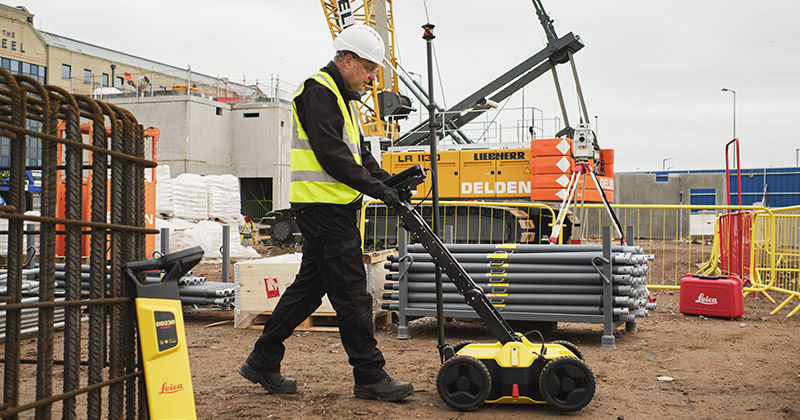
Cable & Service Location Detection
Welcome to our comprehensive selection of ground-penetrating radar (GPR) solutions and utility detection equipment. Whether you're a professional in construction or utility maintenance or simply need to detect subsurface structures, we have the tools you need to ensure efficient and accurate results.
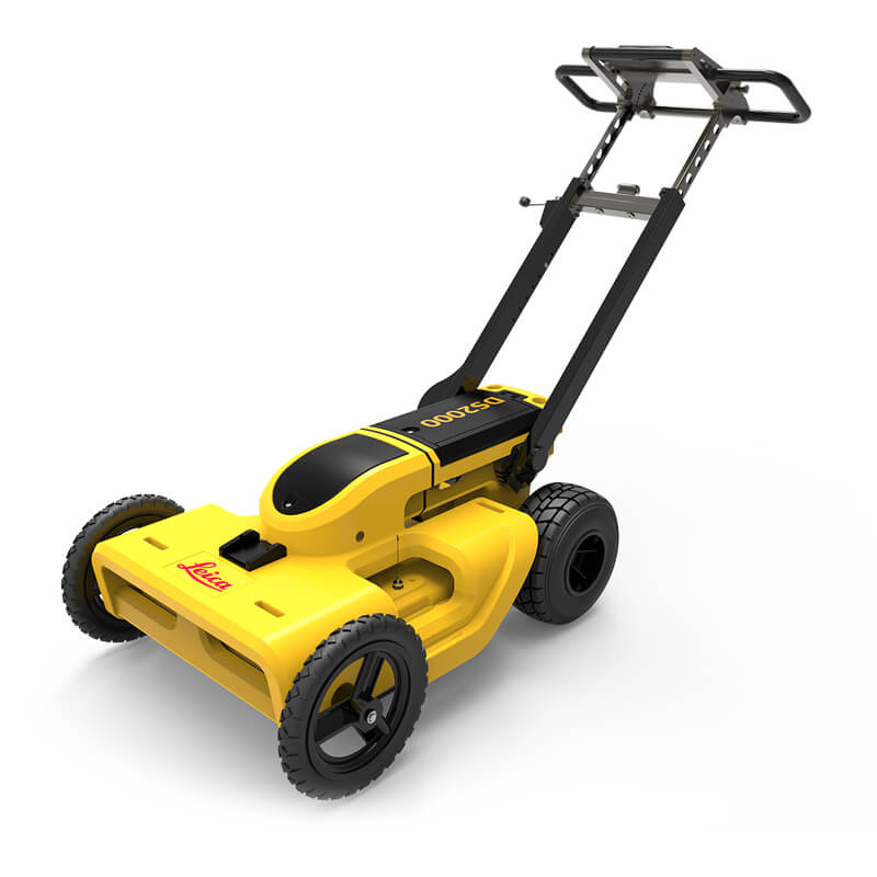
Ground Penetrating Radar (GPR)
Our GPR solutions utilize cutting-edge technology to detect reflected signals from structures within the subsurface. Whether you're searching for buried utilities, voids, or other anomalies, our GPR systems provide precise imaging and reliable results.
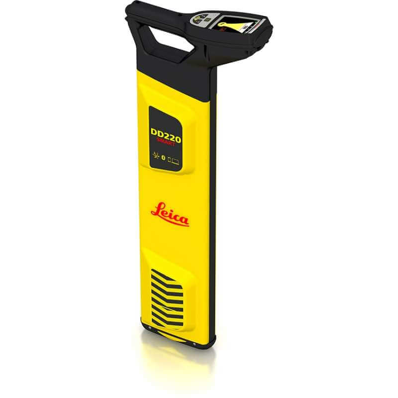
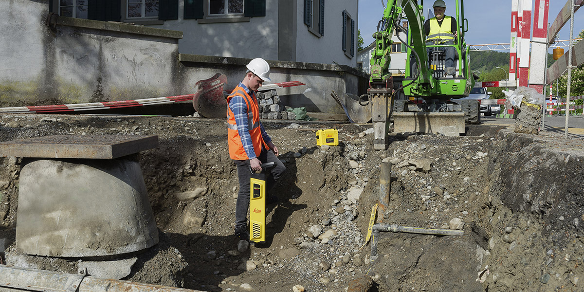
Leica DD SMART Locators
Designed specifically for utility professionals and anyone involved in excavation work, Leica DD SMART Locators offer advanced detection solutions. With features tailored to enhance safety and efficiency, these locators are indispensable tools for accurately mapping underground utilities.
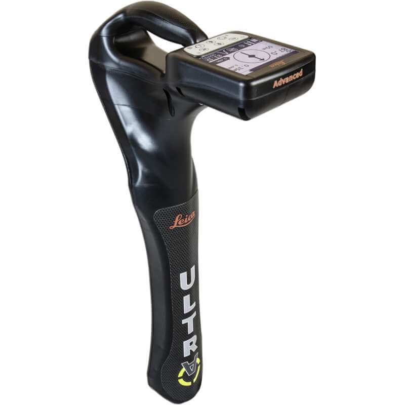
Cable Detection
Our ULTRA Systems offer unparalleled precision in locating and tracing utilities buried beneath the ground. Whether you're dealing with electrical cables, pipes, or other buried infrastructure, our cable detection solutions ensure precise identification and mapping.
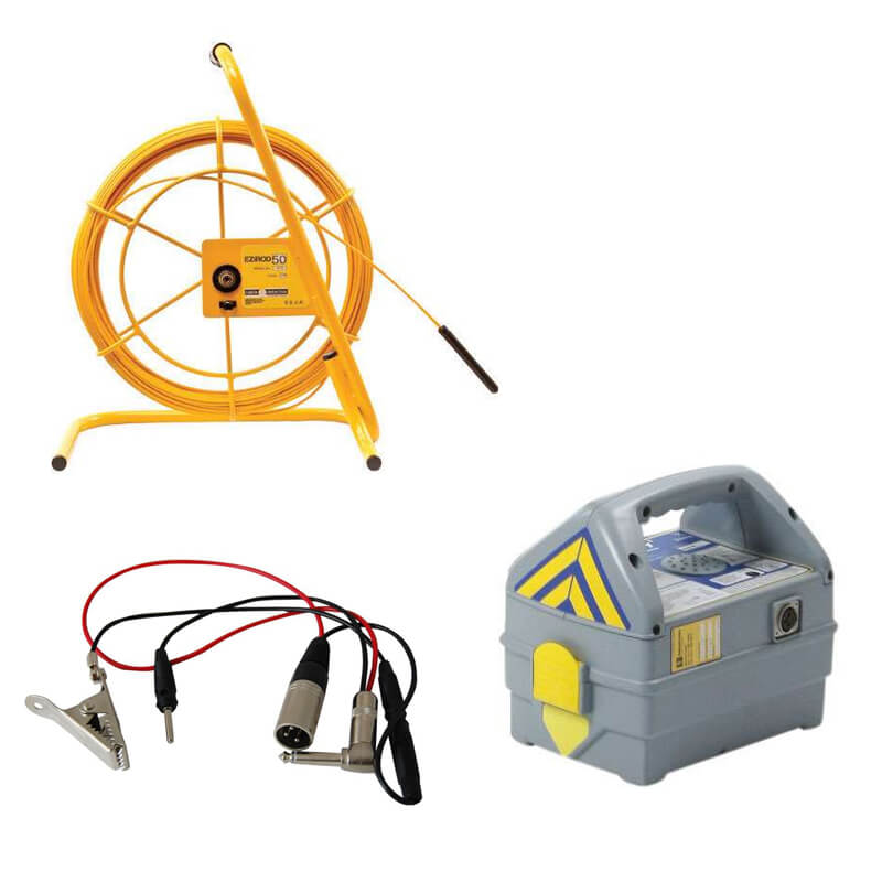
Cable Avoidance Accessories
Enhance the functionality of your location detection equipment with our range of cable avoidance accessories. From signal transmitters to marking flags, we provide the supporting equipment necessary to optimize the performance of your detection tools.
Whether you're looking to purchase or hire equipment, our range of solutions caters to various needs and budgets. Browse through our selection and equip yourself with the tools necessary to tackle subsurface detection tasks with confidence.
Ground Penetrating Radar
Leica DD SMART Locators
Cable Detection
Cable Avoidance Accessories
Underground Utility Locators
What is a utility locating?
Utility locating is a process of identifying the location of underground utilities before excavation work is carried out.
A common method involves using electromagnetic currents which work to detect underground utilities that contain conductive materials. This is a proven method for locating essential utilities such as pipes, cables and sewer lines.
When a utility is discovered the surveyor will mark the position and build out a utility map of the underground structures.
Various techniques are used for utility locating including Ground Penetrating Radar (GPR), underground utility locators and cable avoidance tools such as the Leica ULTRA cable detector and smart locators.
Why is utility locating important?
This process is an essential step before excavation to help prevent damage to underground utilities. Accidentally causing a utility strike can lead to severe project disruptions, create safety hazards and result in costly repairs.
4 Essential Utility Locator Tools You Need Today
Ground Penetrating Radar (GPR)
This utility location tool uses radar pulses to create an image of the subsurface. This non-destructive technology works by emitting high-frequency electromagnetic waves into the ground and measuring the reflected signals that bounce back from subsurface structures or materials with different electrical properties.
GPR is valuable for mapping and detecting underground utilities such as pipes, cables, and other infrastructure. It allows surveyors to visualise the location, depth, and orientation of utilities before excavation work commences, helping prevent damage and ensure the safety of construction projects.
Explore our range of GPR solutions.
SMART Locators
These are essential for anyone breaking ground and can also be known as a technologically advanced utility locating device.
The Leica DD SMART Locator is a Service Location Tool used to identify underground assets at greater depth, faster and more accurately than any other system on the market.
Unlike other cable detection tools, Leica’s SMART utility locator solution allows users to detect buried utilities and transfer and access data remotely to a hosted service for multiple users, across multiple sites. This enhances site management for maximum efficiency.
Streamline Construction Site Operations with DX Shield software
Our cable avoidance tools feature cutting-edge Bluetooth technology, enabling wireless connectivity to field controllers and mobile devices.
Effortlessly transfer and retrieve data stored in your utility locators' internal memory, seamlessly connecting on-site personnel with office operations.
Access and synchronise collected data using your smartphone! The DX Field Shield app serves as a remote transfer tool, seamlessly linking site data to DX Office Shield or DX Manager Shield hosted services. This provides a useful, centralised platform for multiple users across various sites.
View SMART Locators.
Cable Detection Tools
A cable detector is an excavation safety tool used to detect the presence of underground utilities before excavation breaks ground. By using cable avoidance tools like the Leica ULTRA construction personnel can avoid the risk of a utility strike when carrying out excavation work.
Precision utility tracing systems and cable avoidance tools, such as the Leica ULTRA Locator surveyors can detect buried cables’ position by searching for their electromagnetic field.
It is estimated that up to 60% of subsurface utilities could be missed when detecting with just a cable locator on its own as many utilities do not carry a live current or transmit a radio signal. In order to find these utilities it is recommended that an electric current or signal is applied to the subsurface metal which will then enable the utility to be picked up by the cable detection tools.
View cable detection tools.
Reduce Cable Strikes with EZiDIG Software
EZiDIG is a software solution designed to streamline and enhance the process of underground utility location and excavation management. It's commonly used in construction and utility industries to improve efficiency, accuracy, and safety during excavation projects.
The software enables surveyors to create detailed maps of underground utilities, helping to identify their precise locations before excavation begins.
EZiDIG software also assists in planning excavation projects by providing information on the location and depth of underground utilities, helping to avoid accidental damage during construction.
Find out more.
Book a free consultation
If you would like advice on getting the right underground utility locator for your project please contact a member of the team. Contact us.