Release of Leica Zeno Mobile Data Collection Software
Leica Zeno Mobile is a complete tool for data capture with the simplicity of an Android app. With an outstanding intuitive way of data collection, managing assets has never been so simple.
Click here for the Zeno 20
New Zeno Mobile Features At A Glance
GNSS Correction Auto Connect
- As soon as you have a position, the selected RTK profile will be utilized to automatically.
- A switch allows you to disable this functionality if needed.
- The Auto connect is ON by default, you can switch off any time.
|
 |
Attribute reordering
- Drag and drop an attribute to a new position to reorder the attributes in the Attributes dialog.
|
Position Limits
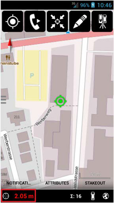
- Define quality limits to ensure certain accuracy for your measurements.
- Time and Distance limits are available.
|
Streaming
- Continuously capture points/vertices. This is now possible using streaming mode based on time and distance intervals.
|
 |
From ArcGIS/Zeno Office to Zeno Mobile
- Define a data model in ArcGIS/Zeno Office
So far Zeno Mobile projects had to be defined in Zeno Mobile or Excel only. Now an empty data schema can be generated in the GIS as well.
- Installation:
- Download the Zeno Data Model for ArcGIS add-in from my World (“tools” section in Zeno
- Field/Zeno Mobile/Zeno Connect).
- Make sure Zeno Office/ArcGIS is closed
- Double-click the add-in to start the installation
- Start ArcGIS/Zeno Office and load/generate your data
- Supported data formats are shapes, file/personal geodatabases, dxf, dwg
- Right-click a layer and select Zeno Export
- For further information please refer to the “Zeno Data Model for ArcGIS_Quick Guide”
|
Posted On: October 5, 2016

