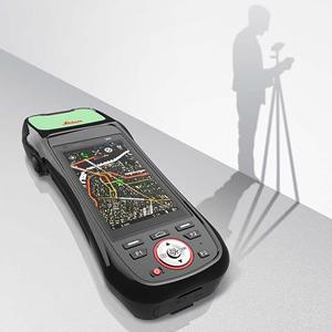
Leica Zeno Mobile is a complete tool for data capture with the simplicity of an Android app. With an outstanding intuitive way of data collection, managing assets has never been so simple. Click here for the Zeno 20 New Zeno Mobile Features At A Glance GNSS Correction Auto Connect As soon as you have a position, the selected RTK profile...
General
-
Update New Ordnance Survey Coordinates Tutorial
Following the recent changes to Ordnance Survey GNSS control networks and geoid models, we have created two easy to understand video tutorials. Each should help with updating both Leica Captivate and Leica Viva instruments with the updated coordinates. Click here to watch the videos and find more helpful guides. -
No-Dig Live 2016
SCCS will be exhibiting at the EZiCAT i750 and Leica DS2000 at No-Dig Live 2016. 20th - 22nd September. Peterborough Arena, East of England Showground. Stand 23 The Cable Detection EZiCAT i750 SMART is the world’s first SMARTREADY locator, capable of seamless communication to 94% of mobile technologies. Connects to both Apple and Android devices to allow in field transfer... -
SCCS supply Jackson Civil Engineering with state-of-the-art surveying kit
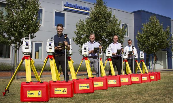
SCCS supply Jackson Civil Engineering with state-of-the-art surveying kit in a bid to work smarter and more efficiently. The investment consists of ten top of the range Leica Total Stations which have been purchased in order to standardise the Jackson fleet. A LEAN review earlier this year identified that the variety of instruments used by our engineers was wide ranging... -
MicroSurvey STAR*NET 8.2 Release
FREE upgrade to all SCCS customers who are currently using MicroSurvey STAR*NET on an existing maintenance contract. Excellent offers for all new or existing out of software maintenancecustomers, please contact us for details. MicroSurvey Software Inc. is pleased to announce the release of MicroSurvey STAR*NET 8.2, the latest and highly anticipated version of the industry-leading STAR*NET least squares network adjustment...
