We are pleased to announce the release of the GeoMoS v7.3 software suite: GeoMoS Monitor, GeoMoS Analyzer and GeoMoS Now! Release highlights: In-Place Inclinometer API Key New virtual sensor and graph templates for in-place inclinometers The new in-place inclinometer support is a very important component that now completes the GeoMoS software suite for large geodetic and geotechnical monitoring projects. The...
Technical
-
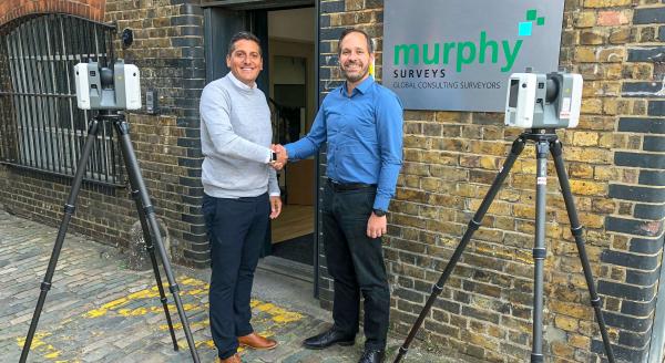
Murphy Surveys become the first surveying company in the UK & Ireland to receive the Leica RTC360 Reality Capture Solution
SCCS, part of Hexagon, is pleased to announce the provision of the Leica RTC360, the world’s first 3D laser scanner with automatic in-field pre-registration to Murphy Surveys, a leading land and engineering surveying company. Murphy Surveys has become the first organisation in the UK and Ireland to invest in the new scanner, reaffirming their position as a pioneer in the... -
GPS Base Station Notification
For GPS base station users, we have identified some issues when going to measure points. Users may notice the 3DCQ value has not reached 30mm or below. This is due to some maintenance being carried out throughout the UK. To resolve the issue please be patient, however, if after a few minutes the resolution is still above 30mm try reinitialising... -
Identifying Safety Solutions for Oil and Gas Workers
Confined space is extensively spread at petrochemical and gas refining plants, oil refining, underground areas, such as oil storage tanks, sewage collectors and other areas. The dangers that can be faced when working in confined spaces can result in bodily injury, disease and even death of the operative. It is estimated that working in confined spaces to be 100 to... -
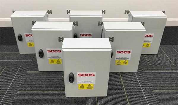
SCCS supply custom built com boxes for the Ferrovial Laing O’Rourke joint venture.
SCCS supply custom built com boxes for the Ferrovial Laing O’Rourke joint venture (FLO) on the Northern Line Extension project at Kennington. 6x ComBoxes are supplied as well as the Leica TM50 instrumentation (used as automated total stations or ATS) and Leica GeoMoS Monitor software system to extend the use of the existing monitoring systems already in use by FLO...


