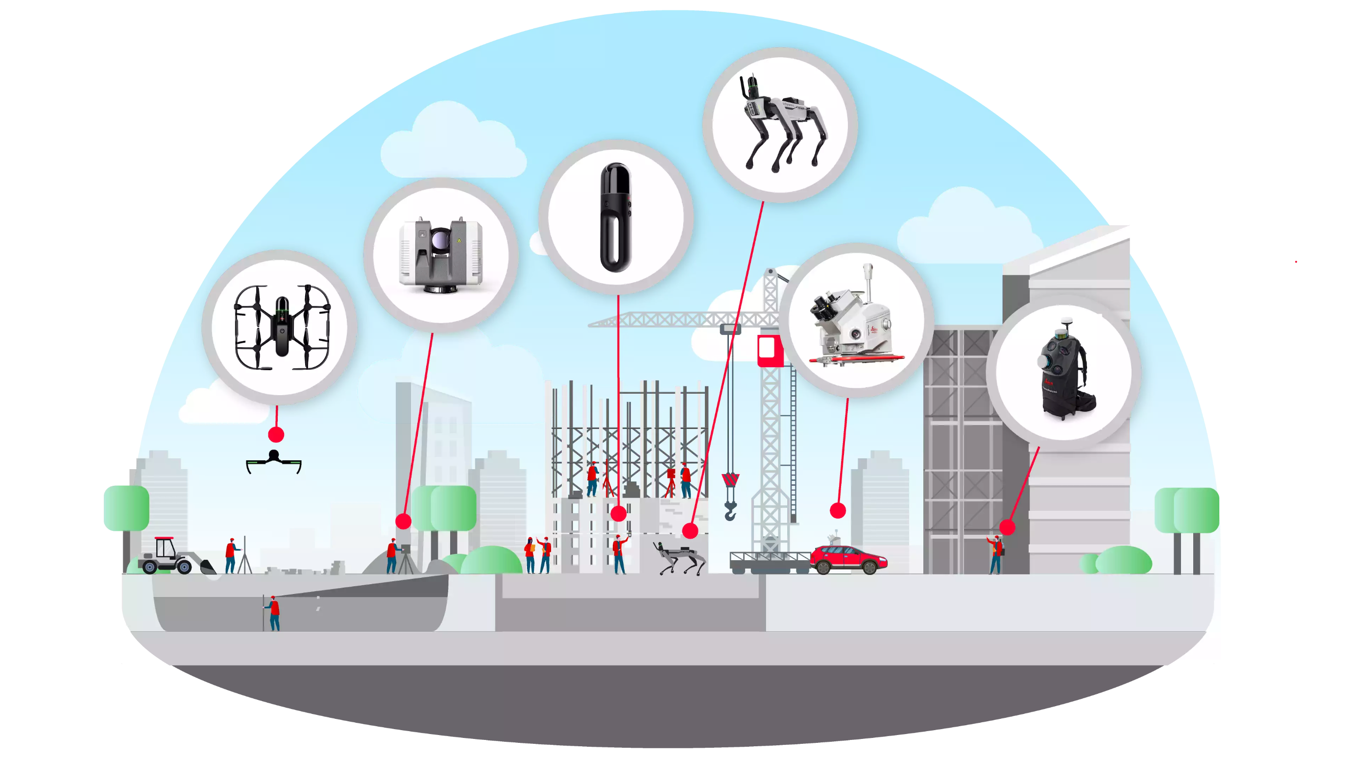
Reality Capture
What is Reality Capture?
Reality capture solutions visualise any environment as it is so you can model with accuracy and precision, using technology such as laser scanners and high-definition 360-degree cameras, to quickly and cost-effectively create a digital representation of the physical world that is useful in design and construction workflows.

How Can I Use Reality Capture?
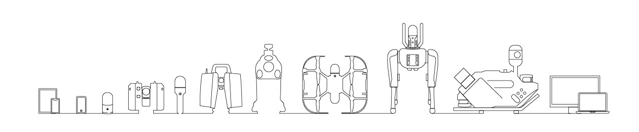
We supply a selection of industry-leading scanners and software to industry professionals to create the most realistic digital environment for the most accurate planning.

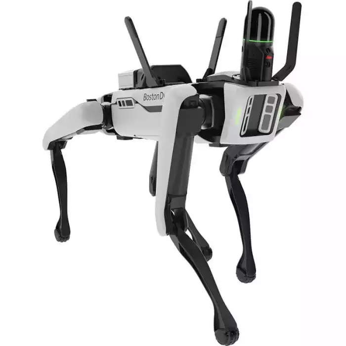
Leica BLK ARC Autonomous Laser Scanning Module
The Leica BLK ARC is an autonomous laser scanning module for robots. It is designed to be integrated with robotic carriers to enable autonomous mobile laser scanning with minimal or no human intervention.
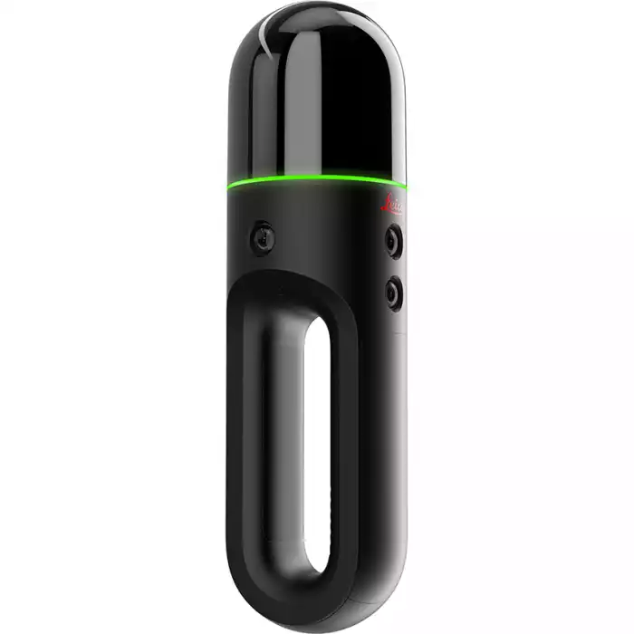
Leica BLK2GO Handheld Laser Scanner
The Leica BLK ARC is an autonomous laser scanning module for robots. It is designed to be integrated with robotic carriers to enable autonomous mobile laser scanning with minimal or no human intervention.
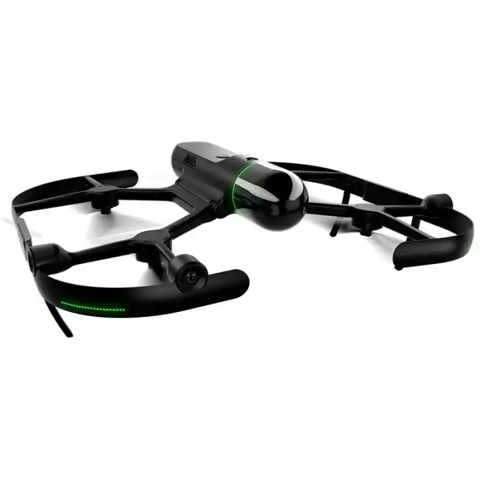
Leica BLK2FLY Autonomous Flying Laser Scanner
The Leica BLK2FLY is an autonomous flying laser scanner with advanced obstacle avoidance for easy reality capture from the sky. It captures building exteriors, structures, and environments to create 3D point clouds while flying.
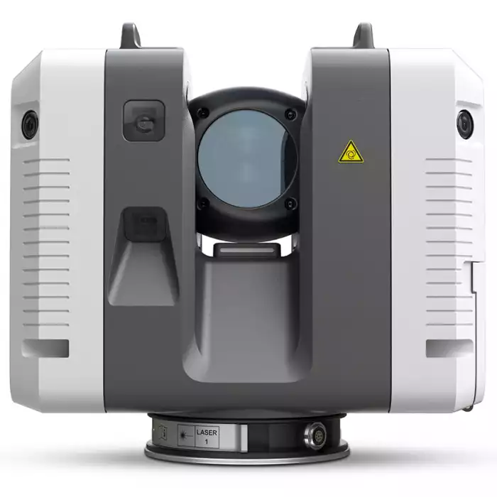
Leica RTC360 Laser Scanner
The Leica RTC360 laser scanner makes 3D reality capture faster than ever before. With a measuring rate of up to 2 million points per second and advanced HDR imaging system, the creation of colored 3D point clouds can be completed in under 2 minutes.
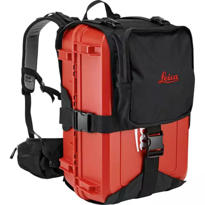
Leica GVP716 Backpack carrying system
Easy-to-mount backpack system for carrying all large TPS and GPS container including TS/MS60 containers.
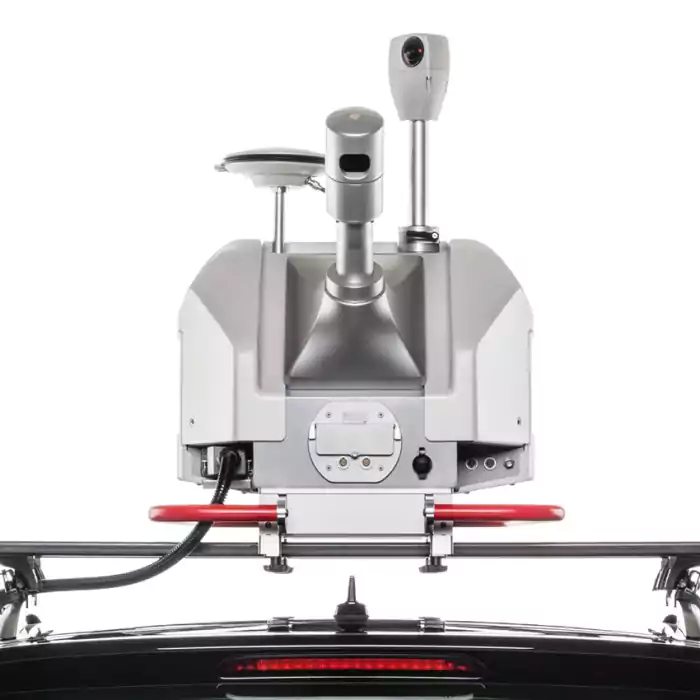
Leica Pegasus Construction
The Leica Pegasus:Swift is a vehicale independent, mapping solution combining LiDAR and high resolution 360° seamless panoramic images for GIS based applications - utility right-of-way, mining , construction, city planning and clearances.
Click on products to learn more.
What are the Benefits of Reality Capture?
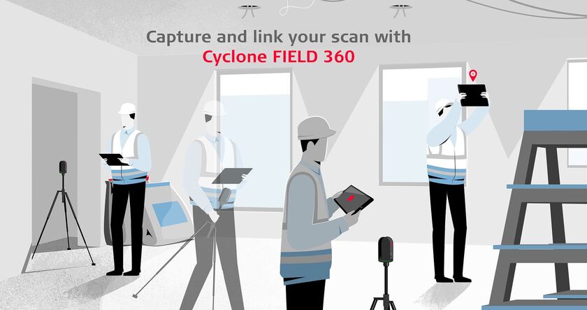
Boost Productivity
The Cyclone FIELD 360’s compactness, flexibility and remote-control capability are combined to improve the user’s productivity.
Easier pre-registration
Scan data from multiple setups captured with the RTC360 laser scanner are automatically tracked and processed by the unique Visual Inertial System (VIS) technology.
Data tagging on-site
On-site tagging is fast and simple – tags persist within Cyclone REGISTER 360 and downstream into TruView, JetStream and CloudWorx for seamless integration from field to finished.
How does Reality Capture Work?
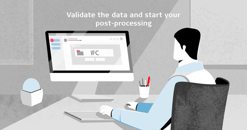
Data is captured on-site through the process of photogrammetry, which is taking numerous pictures of an object or a scene from various angles and distances, this can be done using our cutting-edge technologies, such as the Leica BLK360. For effective decision-making, this information can then be distributed via the cloud to team members located anywhere in the world.
After the data is captured, it is processed to create a 3D model or a point cloud; to help with this, we provide software and office solutions, extracting and recreating the 3D information from 2D is a complex and iterative process that calls for knowledge and close attention to detail, which is where we come in.
Co-ordination and version control are crucial when multiple disciplines collaborate on a project, and information must always be current. It's critical to keep track of changes, especially if you're sending out files that need automatic synchronization. For these scenarios, Hexagon has developed a solution that manages and centralises data.
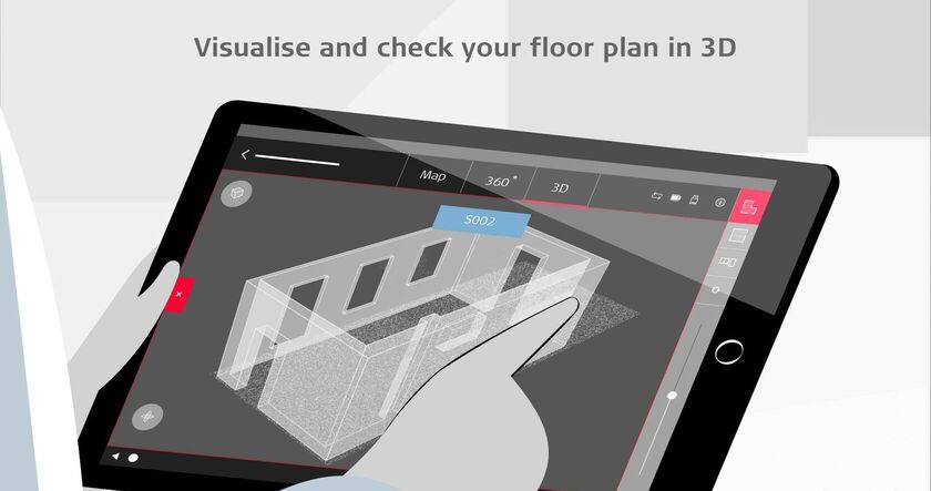
The digital model can be used to increase precision, effectiveness, and creativity in a variety of fields and applications, such as 3D modelling, archaeology, heritage, and architecture. It has the potential to transform the way we work and interact with our physical and digital environments.
Browse our Range of Reality Capture Technology
What is Reality Capture?
Reality capture solutions visualise any environment as it is so you can model with accuracy and precision, using technology to quickly and cost-effectively create a digital representation of the physical world.
How Can I Use Reality Capture?
We supply a selection of industry-leading scanners and software to industry professionals to create the most realistic digital environment for the most accurate planning.
Leica BLK ARC Autonomous Laser Scanning Module
The Leica BLK ARC is an autonomous laser scanning module for robots. It is designed to be integrated with robotic carriers to enable autonomous mobile laser scanning with minimal or no human intervention.
Leica BLK2GO Handheld Laser Scanner
The Leica BLK ARC is an autonomous laser scanning module for robots. It is designed to be integrated with robotic carriers to enable autonomous mobile laser scanning with minimal or no human intervention.
Leica BLK2FLY Autonomous Flying Laser Scanner
The Leica BLK2FLY is an autonomous flying laser scanner with advanced obstacle avoidance for easy reality capture from the sky. It captures building exteriors, structures, and environments to create 3D point clouds while flying.
Leica RTC360 Laser Scanner
The Leica RTC360 laser scanner makes 3D reality capture faster than ever before. With a measuring rate of up to 2 million points per second and advanced HDR imaging system, the creation of colored 3D point clouds can be completed in under 2 minutes.
Leica GVP716 Backpack carrying system
Easy-to-mount backpack system for carrying all large TPS and GPS container including TS/MS60 containers.
Leica Pegasus Construction
The Leica Pegasus:Swift is a vehicale independent, mapping solution combining LiDAR and high resolution 360° seamless panoramic images for GIS based applications - utility right-of-way, mining , construction, city planning and clearances.
What are the Benefits of Reality Capture?
Boost Productivity
The Cyclone FIELD 360’s compactness, flexibility and remote-control capability are combined to improve the user’s productivity.
Easier pre-registration
Scan data from multiple setups captured with the RTC360 laser scanner are automatically tracked and processed by the unique Visual Inertial System (VIS) technology.
Data tagging on-site
On-site tagging is fast and simple – tags persist within Cyclone REGISTER 360 and downstream into TruView, JetStream and CloudWorx for seamless integration from field to finished.
How does Reality Capture Work?
Data is captured on-site through the process of photogrammetry, which is taking numerous pictures of an object or a scene from various angles and distances, this can be done using our cutting-edge technologies, such as the Leica BLK360. For effective decision-making, this information can then be distributed via the cloud to team members located anywhere in the world.
After the data is captured, it is processed to create a 3D model or a point cloud; to help with this, we provide software and office solutions, extracting and recreating the 3D information from 2D is a complex and iterative process that calls for knowledge and close attention to detail, which is where we come in.
Co-ordination and version control are crucial when multiple disciplines collaborate on a project, and information must always be current. It's critical to keep track of changes, especially if you're sending out files that need automatic synchronization. For these scenarios, Hexagon has developed a solution that manages and centralises data.
The digital model can be used to increase precision, effectiveness, and creativity in a variety of fields and applications, such as 3D modelling, archaeology, heritage, and architecture. It has the potential to transform the way we work and interact with our physical and digital environments.
Leica iCON Construction Tools
The importance of digital measurement and layout techniques is growing due to increased project complexity, digitalization, and the industry's need for clear documentation. The Leica iCON iCS20 and iCS50 3D tools simplify tasks with visual measurement technology, automated workflows, and intuitive software, requiring minimal training for quick deployment.
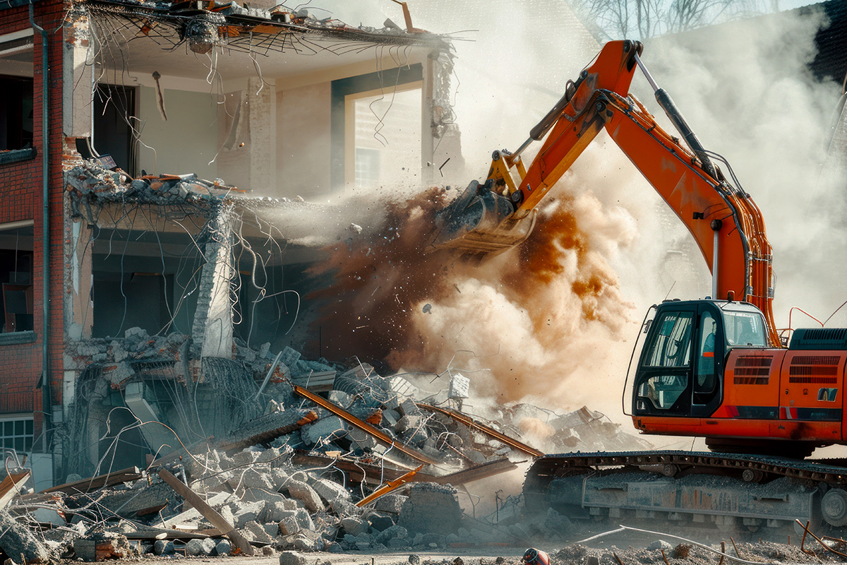
Implementing Noise, Dust, and Vibration Monitoring for Civil Engineering Projects in UK Cities
As UK cities grow, urban construction projects face increasing scrutiny over environmental impacts like noise, dust, and vibration. These factors can affect public health, safety, and nearby structures, especially in densely populated areas or near schools, hospitals, and heritage sites. Poor management can lead to noise complaints, air quality violations, and even structural damage, resulting in delays, fines, or costly project setbacks. Monitoring helps ensure regulatory compliance, safeguard communities, and protect sensitive buildings.

How SCS JV is using the latest technology and methods to shape the future
Watch this fantastic video on how the SCS JV surveyors and engineers are pushing boundaries with cutting-edge technology and innovative methods to construct two 13-mile tunnels in London. With state-of-the-art digital tools and advanced engineering solutions, the team are committed to efficiency, shaping a roadmap that will set the standard for future projects. Watch Now
Skanska Engineering Technology Day
SCCS hosted an Engineering Technology Day for Skanska at the Leica Geosystems School and introduced new technology and innovations to a wide range of roles across Skanska. Learn More
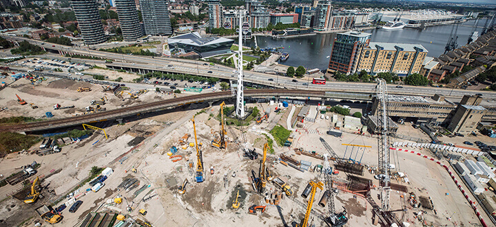
London’s Silvertown Tunnel Project
Due to open in 2025, this infrastructure project is utilising the latest surveying equipment to efficiently capture images and measure points. Learn More
Used reconditioned surveying equipment. Inspected, certified and guaranteed.