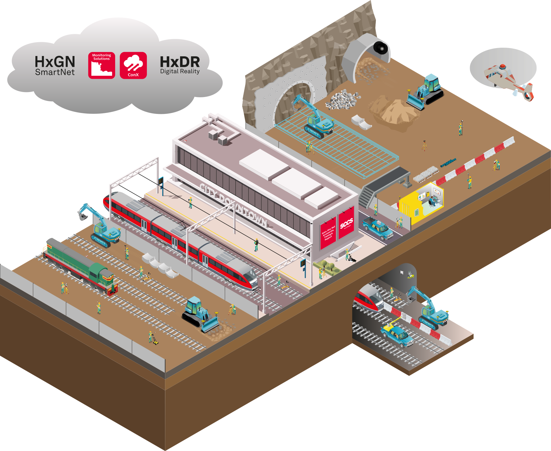
The SCCS Rail Journey
As the leading supplier of survey equipment to the rail industry, we provide intelligent solutions and support to our customers throughout the life cycle of their railway, heavy construction, and infrastructure project to increase productivity and quality.
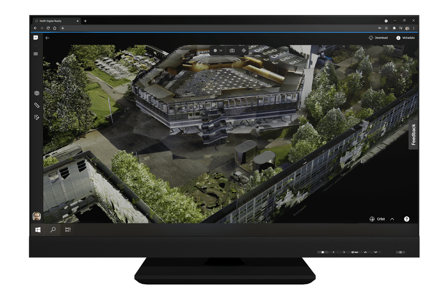
Explore Our Interactive Map

Leica Zeno FLX100 Smart Antenna
The Leica Zeno FLX100 smart antenna captures spatial data in a simple and flexible way allowing you the freedom to work how you want.

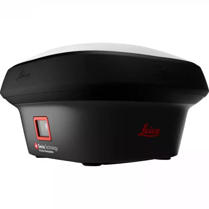
Leica GS18 I GNSS RTK Rover
Meet the Leica GS18 I GNSS RTK rover with Visual Positioning. With it you can effortlessly measure points you couldn’t reach before.
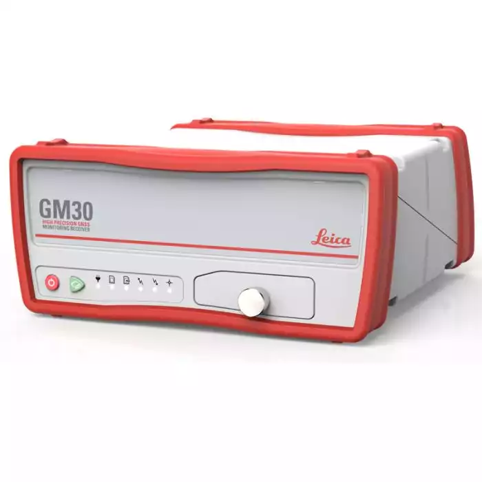
Leica GM30 Receiver
Future-proof and intelligent, this instrument delivers the highest quality results round the clock.
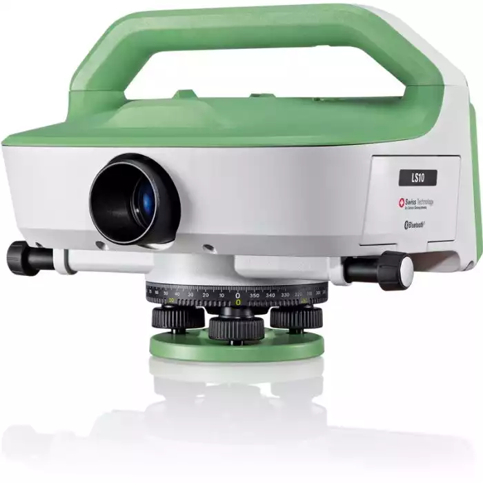
Leica LS15 Digital Level
From measuring roads, railways, bridges or other structures, the Leica LS Digital Levels provide reassurance and ease to an extensive range of complicated levelling applications.
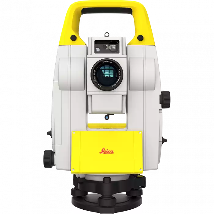
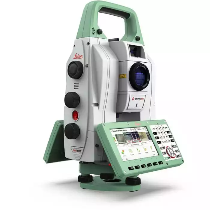
Leica Nova MS60 MultiStation
The new version of Leica Nova MS60, the world’s first MultiStation, allows you to complete all surveying tasks with one instrument.

Leica AP20 AutoPole
The Leica AP20 AutoPole is a unique smart solution for our automated total stations that boosts on-site productivity.

IDS GeoRadar - Stream DP
The Stream DP is a sophisticated ground-penetrating radar system that offers high-resolution imaging, real-time data acquisition, and advanced processing capabilities.
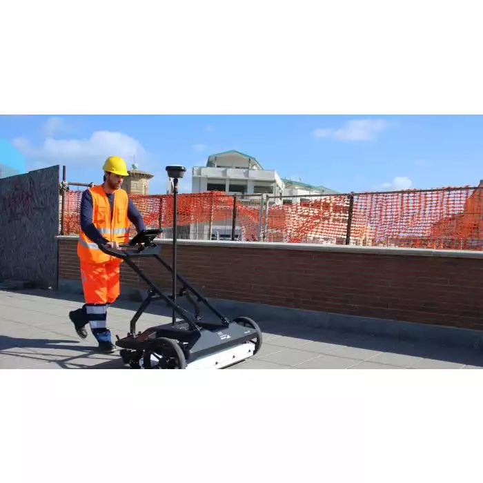
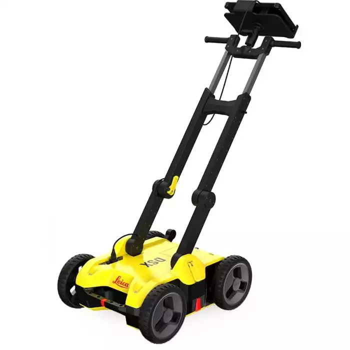
Leica DSX Utility Detection Solution
For utility repair and maintenance, civil engineering and surveying companies, the Leica DSX utility detection solution, consisting of portable hardware with intuitive software allows to easily locate, visualise and map utilities.


Leica iCON GPS 60 GNSS Smart Antenna
The Leica iCON GPS 60 GNSS Smart Antenna is an impressive and versatile SmartAntenna for on-site positioning projects.
Leica MC1 3D machine control software
To support the digitisation of the heavy construction industry, Leica Geosystems offers a revolutionising software platform for all machine control solutions.
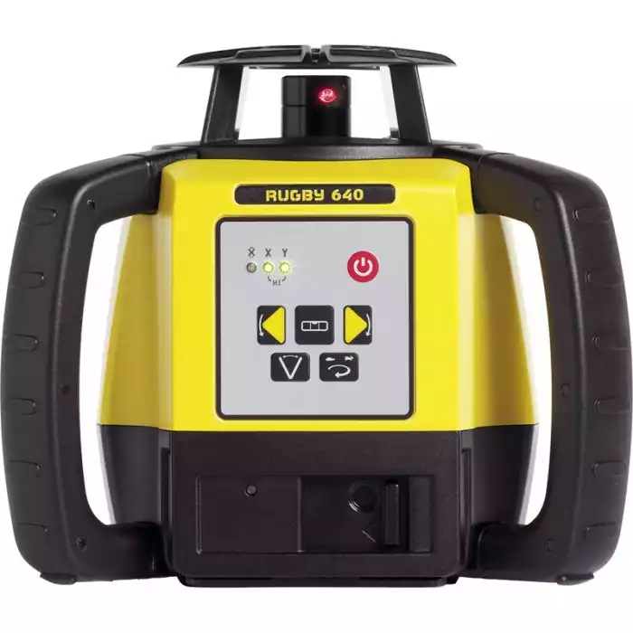
Construction Lasers
We supply a complete range of Exterior Laser Levels providing confidence and features needed, for any sized job across general construction and exterior levelling.
Leica iCON iCT30 Construction Layout Tool
Increased complexity in construction projects and the strong trend towards digitalisation and Building Information Modelling (BIM) in the Building Construction industry make digital layout methods and processes crucial.
City Mapper Ariel LIDAR
For fast and efficient digitisation of cities, this hybrid oblique imaging and LiDAR solution provides the highest productivity and unmatched data accuracy

Leica Pegasus TRK Neo
The Leica TRK Neo is a powerful mobile mapping system that can help you save time and improve the accuracy of your geospatial data collection.

Pegasus BackPack
Experience the freedom of high-quality mapping on the move with the Leica Pegasus Backpack - the ultimate mobile mapping solution.

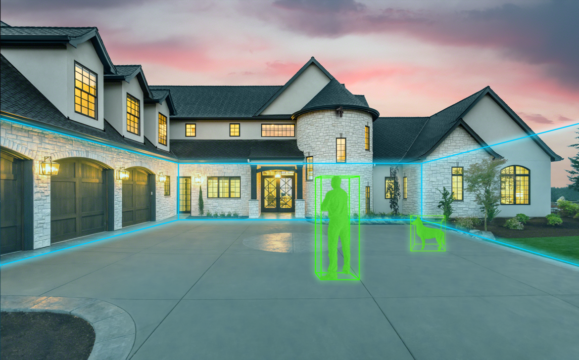
Leica BLK2GO Handheld Laser Scanner
The blk2go handheld imaging laser scanner recreates spaces in 3d as you move. It captures images and dimensionally accurate point clouds in real-time and uses slam technology to record your trajectory through space.

Leica Infinity Software
Leica Infinity is not just an easy-to-use software designed for geospatial measurement experts, but also a highly efficient tool that revolutionizes the connection between field work and office work, boosting productivity like never before.

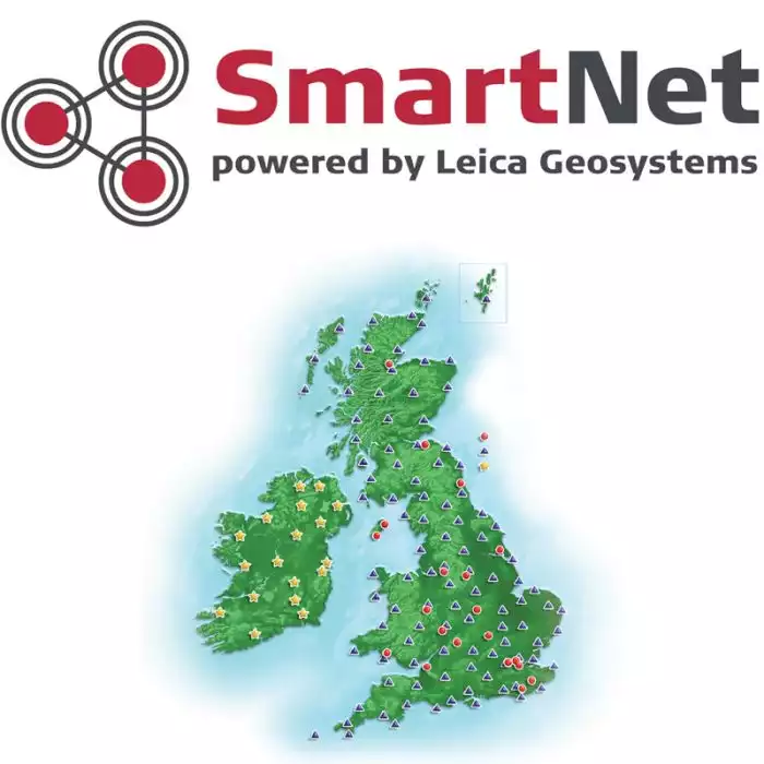
Leica SmartNet National GNSS Network Solution
SmartNet is a 24/7, accurate, reliable and robust National GNSS Network solution, based on a common datum, for the entire positioning community of Great Britain.
Leica ConX
A cloud-based collaboration platform that is open, simplified, and user-friendly, enabling seamless management and transfer of data.

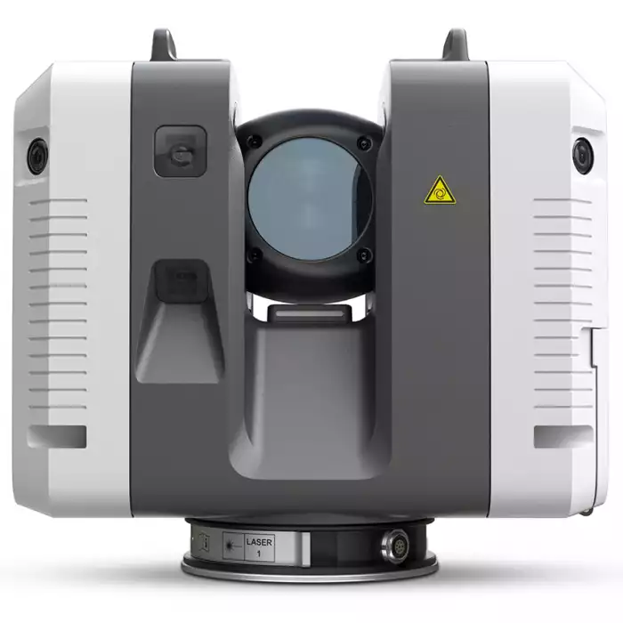
Leica Nova TM60 Monitoring Station
Leica Geosystems’ new monitoring solution comes with a strong promise: real-time information and reports you can always rely on, helping you make informed decisions in time and on time.
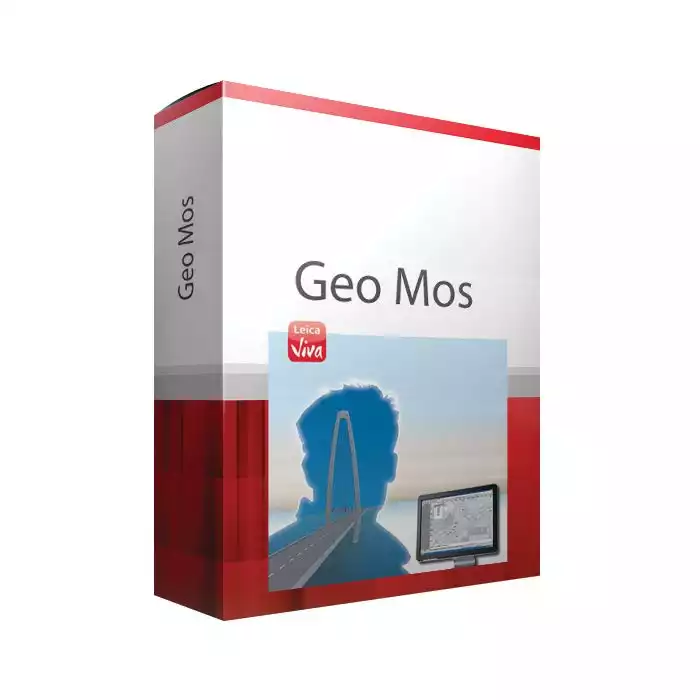
Leica GeoMoS
The Leica GeoMoS software provides a highly flexible automatic deformation monitoring system that is able to combine geodetic, geotechnical and meteorological sensors to match the needs of your monitoring project, whether it is large or small, temporary or permanent.
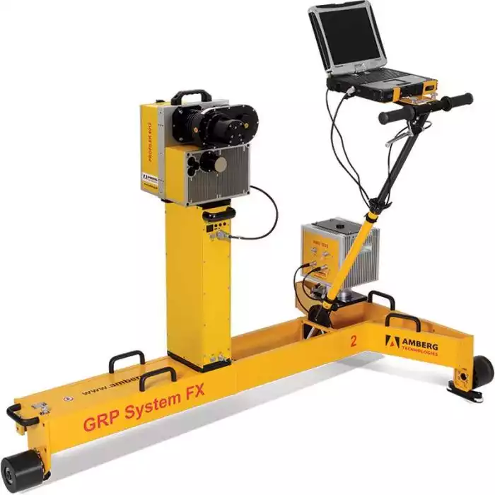
Amberg Rail Clearance IMS 5000
Complete railway infrastructure data in no time – simple and high performance.
Training & Support
SCCS offer flexible courses designed to suit your company's needs and the professional development of your staff. Whether you use a simple distance measuring device or the most sophisticated integrated solution, SCCS provide training by experienced and specialist staff.

Leica Nova MS60 MultiStation
The new version of Leica Nova MS60, the world’s first MultiStation, allows you to complete all surveying tasks with one instrument.
Leica AP20 AutoPole
The Leica AP20 AutoPole is a unique smart solution for our automated total stations that boosts on-site productivity.
Leica MC1 3D machine control software
To support the digitisation of the heavy construction industry, Leica Geosystems offers a revolutionising software platform for all machine control solutions.
Amberg Rail Clearance IMS 5000
Complete railway infrastructure data in no time – simple and high performance.
Leica iCON iCT30 Construction Layout Tool
Increased complexity in construction projects and the strong trend towards digitalisation and Building Information Modelling (BIM) in the Building Construction industry make digital layout methods and processes crucial.
Leica MC1 3D machine control software
To support the digitisation of the heavy construction industry, Leica Geosystems offers a revolutionising software platform for all machine control solutions.
Leica MC1 3D machine control software
To support the digitisation of the heavy construction industry, Leica Geosystems offers a revolutionising software platform for all machine control solutions.
Amberg Rail Clearance IMS 5000
Complete railway infrastructure data in no time – simple and high performance.
Leica Zeno FLX100 Smart Antenna
The Leica Zeno FLX100 smart antenna captures spatial data in a simple and flexible way allowing you the freedom to work how you want.
Leica GS18 I GNSS RTK Rover
Meet the Leica GS18 I GNSS RTK rover with Visual Positioning. With it you can effortlessly measure points you couldn’t reach before.
Leica GM30 Receiver
Future-proof and intelligent, this instrument delivers the highest quality results round the clock.
Leica LS15 Digital Level
From measuring roads, railways, bridges or other structures, the Leica LS Digital Levels provide reassurance and ease to an extensive range of complicated levelling applications.
Leica Nova MS60 MultiStation
The new version of Leica Nova MS60, the world’s first MultiStation, allows you to complete all surveying tasks with one instrument.
Leica AP20 AutoPole
The Leica AP20 AutoPole is a unique smart solution for our automated total stations that boosts on-site productivity.
IDS GeoRadar - Stream DP
The Stream DP is a sophisticated ground-penetrating radar system that offers high-resolution imaging, real-time data acquisition, and advanced processing capabilities.
Leica DSX Utility Detection Solution
For utility repair and maintenance, civil engineering and surveying companies, the Leica DSX utility detection solution, consisting of portable hardware with intuitive software allows to easily locate, visualise and map utilities.
Leica iCON GPS 60 GNSS Smart Antenna
The Leica iCON GPS 60 GNSS Smart Antenna is an impressive and versatile SmartAntenna for on-site positioning projects.
Leica MC1 3D machine control software
To support the digitisation of the heavy construction industry, Leica Geosystems offers a revolutionising software platform for all machine control solutions.
Construction Lasers
We supply a complete range of Exterior Laser Levels providing confidence and features needed, for any sized job across general construction and exterior levelling.
Leica iCON iCT30 Construction Layout Tool
Increased complexity in construction projects and the strong trend towards digitalisation and Building Information Modelling (BIM) in the Building Construction industry make digital layout methods and processes crucial.
City Mapper Ariel LIDAR
For fast and efficient digitisation of cities, this hybrid oblique imaging and LiDAR solution provides the highest productivity and unmatched data accuracy

Pegasus BackPack
Experience the freedom of high-quality mapping on the move with the Leica Pegasus Backpack - the ultimate mobile mapping solution.
Leica BLK2GO Handheld Laser Scanner
The blk2go handheld imaging laser scanner recreates spaces in 3d as you move. It captures images and dimensionally accurate point clouds in real-time and uses slam technology to record your trajectory through space.
Leica Infinity Software
Leica Infinity is not just an easy-to-use software designed for geospatial measurement experts, but also a highly efficient tool that revolutionizes the connection between field work and office work, boosting productivity like never before.
Leica SmartNet National GNSS Network Solution
SmartNet is a 24/7, accurate, reliable and robust National GNSS Network solution, based on a common datum, for the entire positioning community of Great Britain.
Leica ConX
A cloud-based collaboration platform that is open, simplified, and user-friendly, enabling seamless management and transfer of data.
Leica Nova TM60 Monitoring Station
Leica Geosystems’ new monitoring solution comes with a strong promise: real-time information and reports you can always rely on, helping you make informed decisions in time and on time.
Leica GeoMoS
The Leica GeoMoS software provides a highly flexible automatic deformation monitoring system that is able to combine geodetic, geotechnical and meteorological sensors to match the needs of your monitoring project, whether it is large or small, temporary or permanent.
Amberg Rail Clearance IMS 5000
Complete railway infrastructure data in no time – simple and high performance.
Training & Support
SCCS offer flexible courses designed to suit your company's needs and the professional development of your staff. Whether you use a simple distance measuring device or the most sophisticated integrated solution, SCCS provide training by experienced and specialist staff.
Leica Nova MS60 MultiStation
The new version of Leica Nova MS60, the world’s first MultiStation, allows you to complete all surveying tasks with one instrument.
Leica AP20 AutoPole
The Leica AP20 AutoPole is a unique smart solution for our automated total stations that boosts on-site productivity.
Leica MC1 3D machine control software
To support the digitisation of the heavy construction industry, Leica Geosystems offers a revolutionising software platform for all machine control solutions.
Amberg Rail Clearance IMS 5000
Complete railway infrastructure data in no time – simple and high performance.
Leica iCON iCT30 Construction Layout Tool
Increased complexity in construction projects and the strong trend towards digitalisation and Building Information Modelling (BIM) in the Building Construction industry make digital layout methods and processes crucial.
Leica MC1 3D machine control software
To support the digitisation of the heavy construction industry, Leica Geosystems offers a revolutionising software platform for all machine control solutions.
Leica MC1 3D machine control software
To support the digitisation of the heavy construction industry, Leica Geosystems offers a revolutionising software platform for all machine control solutions.
Amberg Rail Clearance IMS 5000
Complete railway infrastructure data in no time – simple and high performance.

Comprehensive Rail Solutions
As the leading supplier of survey equipment to the rail industry, SCCS provide intelligent solutions and support to our customers throughout the life cycle of their railway, heavy construction, and infrastructure project to increase productivity and quality.

How Surveying is Improving Efficiency in the Rail Industry
Maintaining and improving a rail infrastructure that is in high demand safely and efficiently is the focus of the UK’s rail owners. Finding efficiencies, cutting down operating costs, reducing emissions along with improving journey times and costs for passengers are all important on this journey.